


 Español
 Português
 Italiano
 Français
 Deutsch
Tours
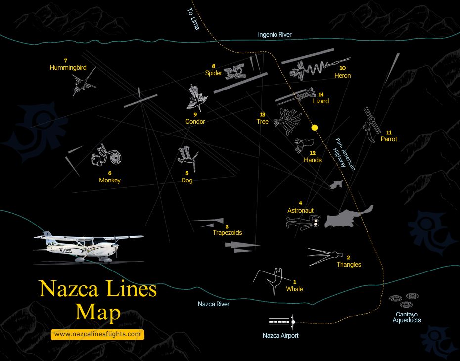
NAZCA LINES MAP
Aug
Your Essential Guide to Exploring Peru’s Mysterious Geoglyphs.
The Nazca Lines Map is an indispensable tool for any traveler wishing to fully appreciate one of Peru’s most fascinating UNESCO World Heritage Sites. Located in the arid plains of southern Peru, the Nazca Lines cover a vast area with hundreds of enormous geoglyphs depicting animals, plants, and geometric shapes. By using a detailed map, visitors can understand the location and orientation of each figure, plan their flight route, and identify the most iconic designs, such as the Hummingbird, Monkey, and Astronaut. Whether you are preparing for a flight over the desert or visiting observation towers, a Nazca Lines map will help you navigate this archaeological wonder and make the most of your journey.
Why the Nazca Lines Map Is Important for Travelers
The Nazca Lines Map is an indispensable tool for any traveler wishing to fully appreciate one of Peru’s most fascinating UNESCO World Heritage Sites. Located in the arid plains of southern Peru, the Nazca Lines cover a vast area with hundreds of enormous geoglyphs depicting animals, plants, and geometric shapes. By using a detailed map, visitors can understand the location and orientation of each figure, plan their flight route, and identify the most iconic designs, such as the Hummingbird, Monkey, and Astronaut.
Location of the Nazca Lines and Key Figures
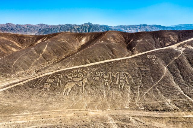
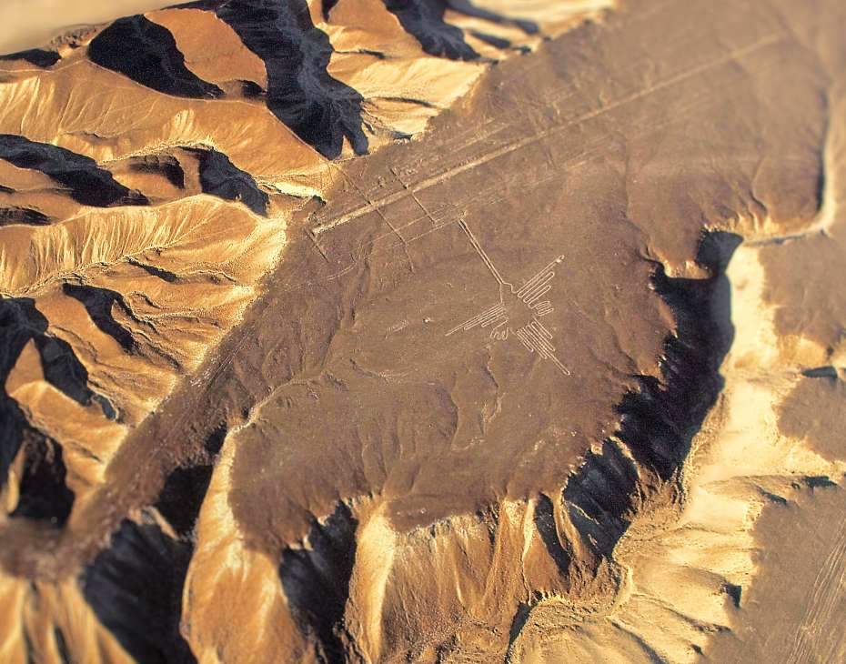
The Nazca Lines are located in the coastal desert plains of southern Peru, about 450 kilometers (280 miles) south of Lima. This vast UNESCO World Heritage Site stretches across an arid plateau between the towns of Nazca and Palpa, covering an area of nearly 500 square kilometers. The Nazca Lines Map reveals that most figures are concentrated in the Pampas de Jumana, a flat expanse where the climate’s extreme dryness has preserved them for over 1,500 years.
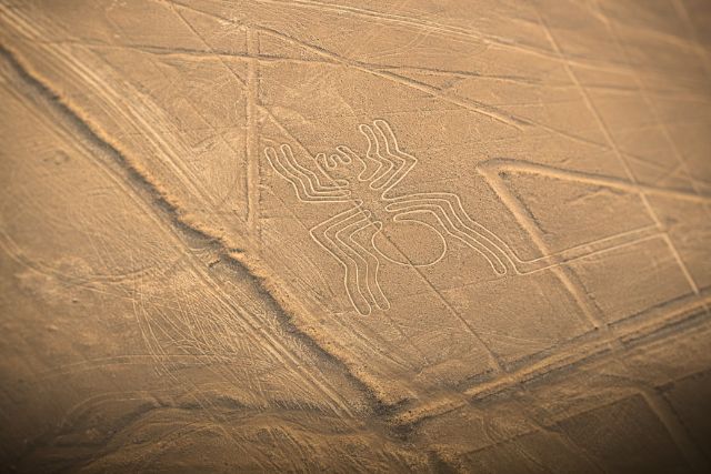
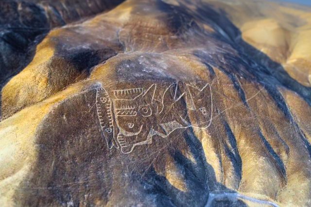
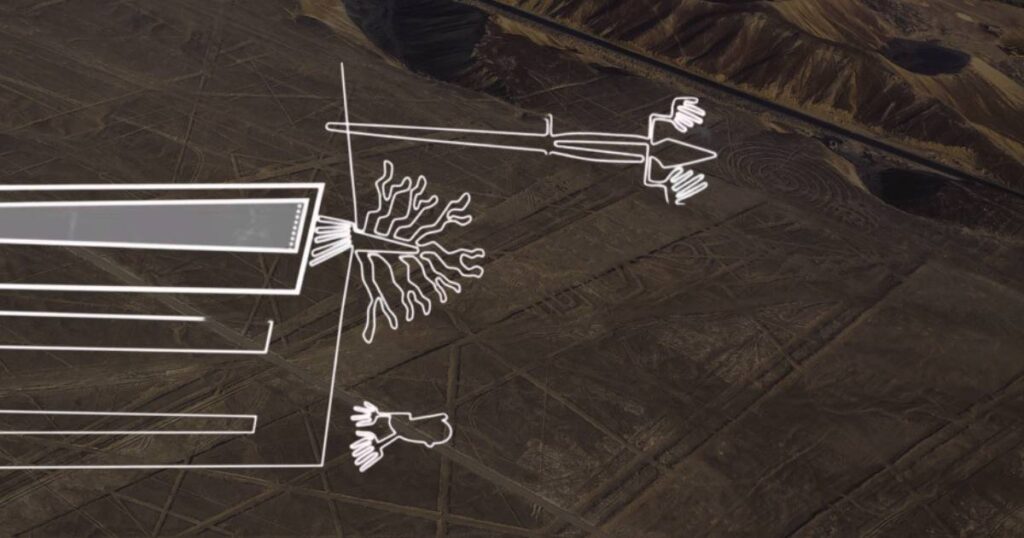
Among the hundreds of geoglyphs, certain designs have become world-famous for their size, precision, and mystery. The Hummingbird, with its perfectly straight beak and delicate wings, lies west of the Pan-American Highway. The Monkey, easily recognized by its spiral tail, is located further north, while the Spider sits near the center of the plateau. Other remarkable shapes include the Astronaut, etched on a hillside, the Condor with its wide wingspan, and the Hands, visible from the metal observation tower along the highway.
How to Use the Nazca Lines Map for Your Trip
A Nazca Lines Map is more than a simple reference—it’s your guide to experiencing the geoglyphs in an organized and meaningful way. Before your visit, review the map to familiarize yourself with the names, shapes, and general positions of the main figures. This will make it easier to identify each one during your flight or while visiting observation points.
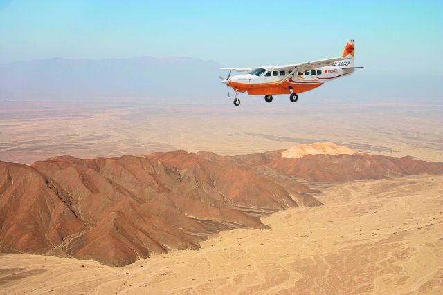
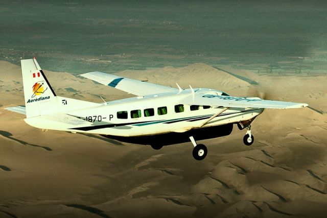
If you are taking a Nazca Lines flight, the experience begins even before you step onto the plane. At the airport, the pilot will give a short briefing explaining how to spot each figure from the air. You will be handed a numbered Nazca Lines Map, which follows the exact flight circuit. The figures are presented in order, starting with the Whale—a giant marine figure that appears just two minutes after takeoff from the Nazca Airport. From there, the plane will follow a set route, passing over each design in sequence so you can match what you see outside the window with the map in your hands.
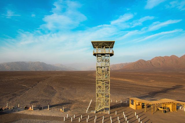
For travelers exploring by land, the Nazca Lines Map helps you locate the two official observation towers along the Pan-American Highway. From here, you can see designs like the Hands, Tree, and Lizard. The map will guide you on which side of the tower to focus your attention, and even where other smaller, less-visited figures are situated in the surrounding desert.
Whether in the air or on the ground, using a Nazca Lines Map transforms your visit from a simple sightseeing trip into an informed exploration of one of the world’s greatest archaeological enigmas.